The use and integration of airborne laser scanning and satellite time series data in precision forest management for plantations of fast-growing tree species
 Key message
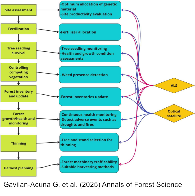
Integrating airborne laser scanning and satellite time series data across the forest rotation enhances decision-making in precision forestry. This review supports forest managers by illustrating practical applications of these remote sensing technologies at different stages of intensive forest plantation management—such as site assessment, monitoring, and silviculture—helping improve productivity, sustainability, and operational efficiency.
Keywords
Harmonized landsat sentinel; Change detection; Leaf area index; Soil properties; Precision forestry
Publication
Gavilan-Acuna, G., Coops, N.C., Tompalski, P. et al. The use and integration of airborne laser scanning and satellite time series data in precision forest management for plantations of fast-growing tree species. Annals of Forest Science 82, 22 (2025). https://doi.org/10.1186/s13595-025-01292-9
Handling editor
Shengli Tao