Forest attribute maps: a support for small area estimation of forest disturbances
 Key Message
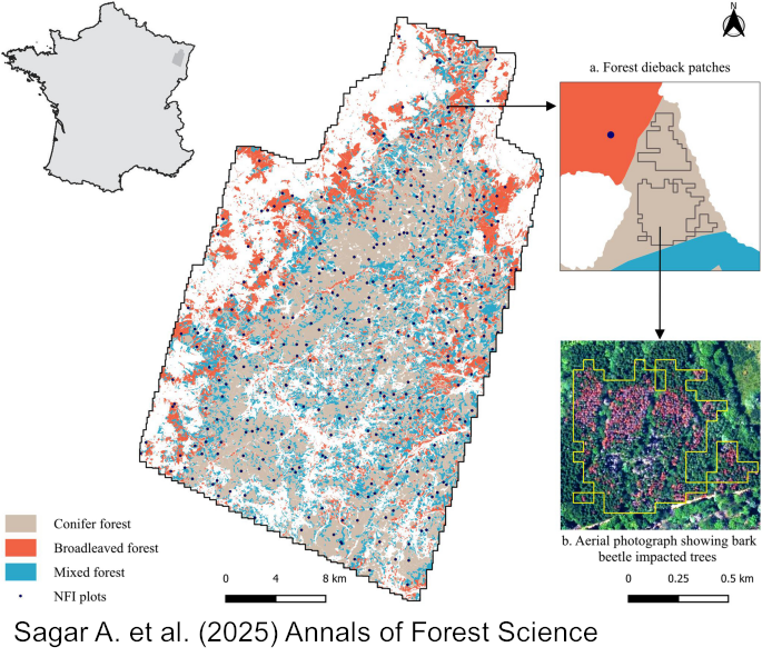
Forest attribute maps generated using national forest inventory and remote sensing data can be used to quantify forest attributes (i.e., growing stock volume, basal area) affected by disturbance events (like bark-beetle induced damage) through small area estimation techniques. Our results showed that mature stands were more sensitive to bark-beetle infestation than younger ones.
Keywords
Multisource forest inventories; Model-based inference; Forest attribute maps; Uncertainty analysis; Forest disturbances; LiDAR
Publication
Sagar, A., Vega, C., Bouriaud, O. et al. Forest attribute maps: a support for small area estimation of forest disturbances. Annals of Forest Science 82, 23 (2025). https://doi.org/10.1186/s13595-025-01293-8
Data availability
The data that support the findings of this study are available online (Vega et al. 2025; https://doi.org/10.5281/zenodo.15276127).
Handling editor
Andreas Bolte
Topical collection
This article is part of the Topical Collection “Impacts of natural disturbances on forest ecosystems under climate change: large-scale analysis and modelling” https://link-springer-com.inrae.idm.oclc.org/collections/fegajbhade