Mapping oak shoot browning in SW Spain using online imagery as virtual prospecting tool
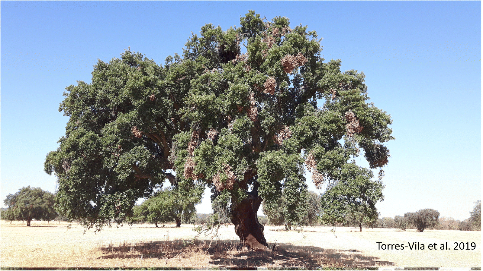 Oak shoot browning is spatially widespread throughout the region of Extremadura (SW Spain) following an aggregative distribution pattern, with a much higher prevalence in cork than in holm oak.
Context Shoot browning is considered a potential contributing or inciting factor to oak decline in SW Iberia. Two causal agents are typically involved, Coraebus florentinus Herbst and a fungal complex in the genus Diplodia Fries (teleomorph Botryosphaeria De Cesati & De Notaris).
Aims Our goals were to map oak shoot browning incidence in Extremadura and to explore geographical/environmental factors potentially involved using a novel image-based prospecting method.
Methods We used online imagery provided by Google Maps/Google Street View. A virtual sampling protocol permitted to inspect, characterise and georeference forest stands and damaged oaks throughout > 5000 km of navigation. Geostatistical interpolation analyses (Indicator Kriging algorithm) and validation processes were conducted to generate probability maps of shoot browning incidence.
Results We prospected 6478 forest stands in which 3410 oaks with shoot browning symptoms were identified and georeferenced. Damage had a clustered distribution pattern both at the regional scale (IK-based probability maps) and the stand scale (fitting to negative binomial function). Factors such as oak species, stand type (pure vs. mixed), treetop orientation, tree aspect, altitude, ground slope and some interactions among them significantly affected shoot browning incidence.
Conclusion We provide the first integrating overview on the distribution and prevalence of oak shoot browning at a regional scale in SW Spain and we also define the effects of some geographical/ecological factors involved.
Keywords
Oak decline, Coraebus florentinus, Diplodia sp., Holm oak, Cork oak, Google Maps
Publication
Torres-Vila, L.M., Echave-Sanabria, A.C., Mendiola-Díaz, F.J. et al. Annals of Forest Science (2019) 76: 32. https://doi.org/10.1007/s13595-019-0818-y
For the read-only version of the full text: https://rdcu.be/buDLL
Data availability
The raw datasets generated in the current study are available in the ResearchGate repository (Torres-Vila et al. 2019). Torres-Vila et al. (2019) Data from Mapping oak shoot browning in SW Spain using online imagery as virtual prospecting tool, Annals of Forest Science. V 06 March 2019. ResearchGate. [Dataset]. https://doi.org/10.13140/RG.2.2.24151.11687.